CAPA DE MAPAS: ❯
It is a set of georeferenced points that represent places of interest for the business, such as branches, gas stations, warehouses, etc.Viewing Map Layers
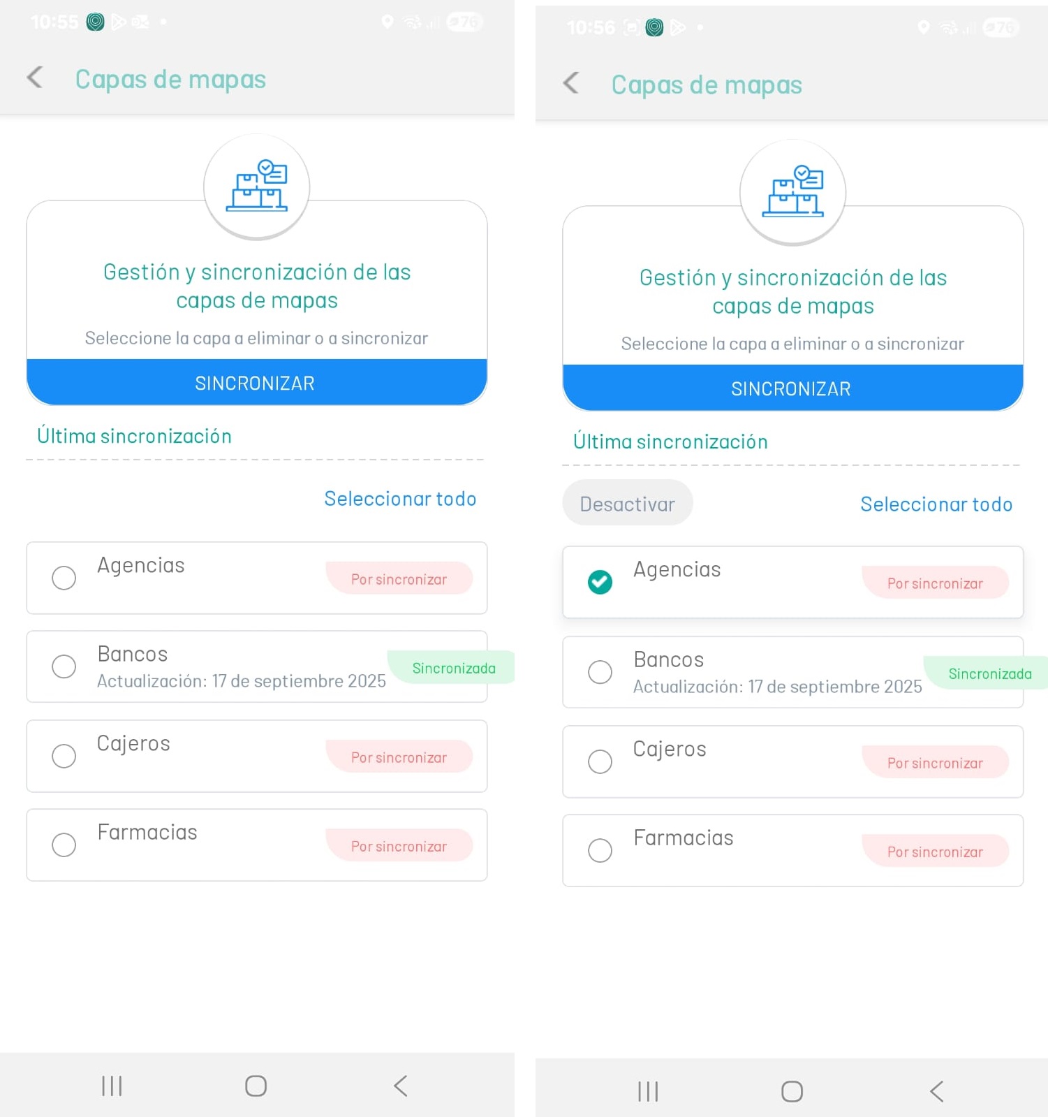
1. In the AFLS Mobile Console, in the Home workspace, select the Configuration on the Taskbar.
2. In the window that is enabled in the Basic Settings section, select the Map Layers, where the specialist will be able to view the defined list of layers and select the record(s) to download to their mobile device.
⚐ Note: The specialist will only be able to view the map layers if the administrator or from the AFLS web console settings, enters and adds the map layers required for the operation.
Synchronize Map Layers
3. In the Map Layers workspace, the specialist will be able to see the date of the last synchronization of the mobile device. Select one or more records from the existing layers and click the SYNCHRONIZE to upload the location points that were created on the AFLS website and view them on the map from the mobile device.
Disable map layers
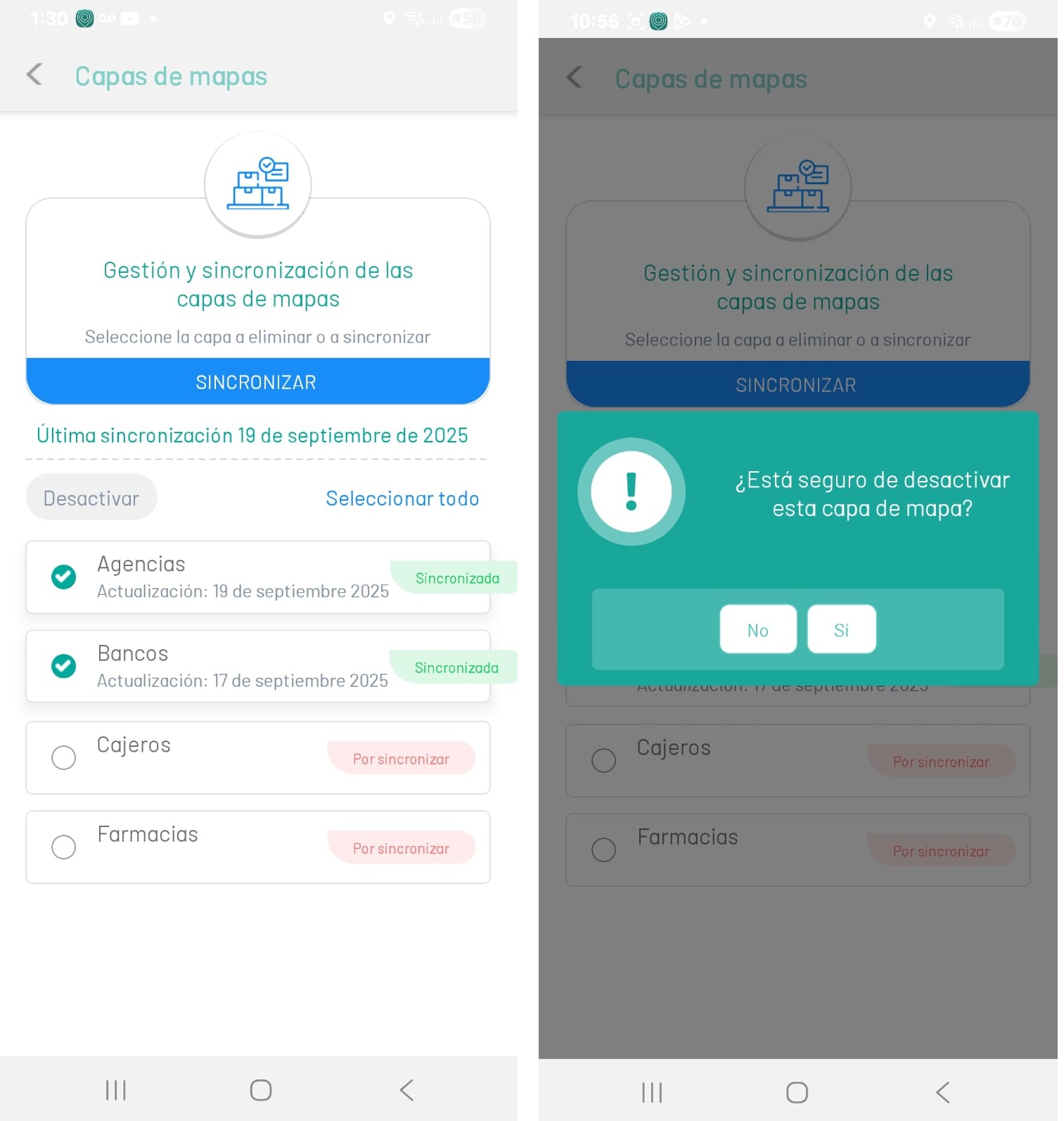
4. In the Map Layers workspace, select one or more records from the existing layers and click the Deactivate. The specialist must confirm the action of deactivating the layer.
When viewing the map, the specialist will not be able to view the deactivated layer.
Viewing Map Layers
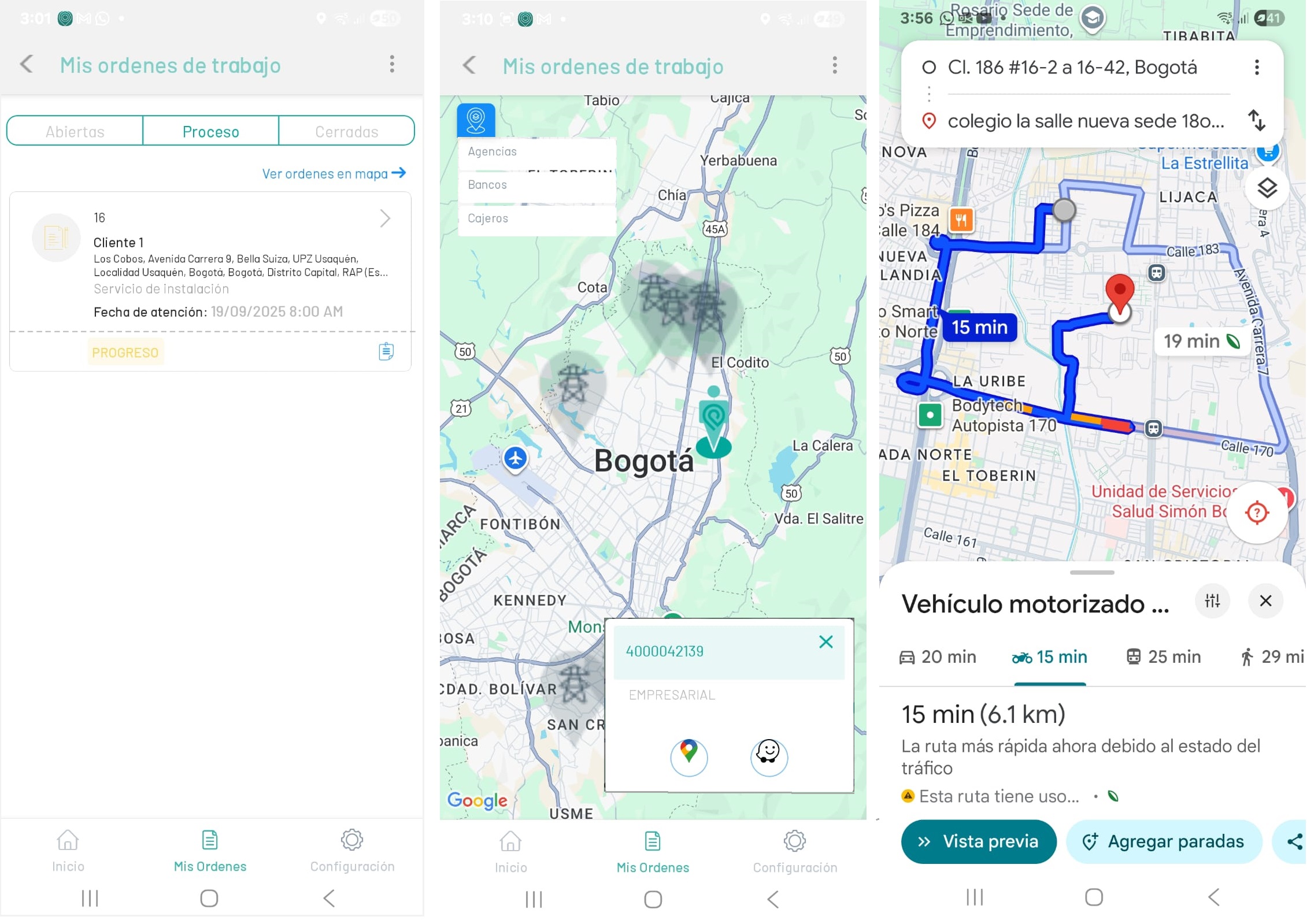
5. In the AFLS Mobile Console, in the Home workspace, select the My Orders on the Task bar and a work order execution status (Open, In Process, Closed).
6. Select the option View Orders on Map. In the window that is enabled, you will be able to view the location of the field specialist and the map layer icon  , with the generated logs.
7. Selecting a map layer record displays the active points in the geographic location. By tapping the dot  the specialist will be able to select a maps and navigation application (Google Maps or Waze) to consult the fastest route to get to the required point.