
Global Settings - GeoJSON Import
In this section of the Global Settings module, you can make fundamental business modifications, such as importing GeoJSON data.
1. In the Aranda FIELD SERVICE web console, in the header menu select the option Profile.
2. From the main menu select the Global Settings. In the Info View, turn on the Enable Editing and in the detail view, complete the Global Settings and Map Settings information for the selected profile.
3. When you enable the editing of global settings fields, a confirmation message is displayed to warn you of the changes to be made to the tool.
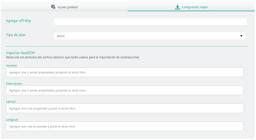
4. In the Global Settings Detail View in the AFLS web console, select the Map Settings, where you can change the service provider for maps in the web app, AssistMe, and mobile app, you can also configure the attributes that will be used from the GeoJson file, when importing locations from the Map Layer functionality.
- The countryside Name it can have multiple attributes.
- The countryside Description it can have multiple attributes.
- The fields Longitude and Latitude they only allow one attribute in their settings.
According to the standard if the GeoJson file has locations that have the Geometry This will prevail over the fields Longitude and Latitude here configured.
5. When you finish configuring the global settings, click Save in the Detail View of the AFLS Configuration Console, to confirm the changes made.