
Comparison between map providers
Below is an example of Geocoding in different countries using all map providers:
CHILE
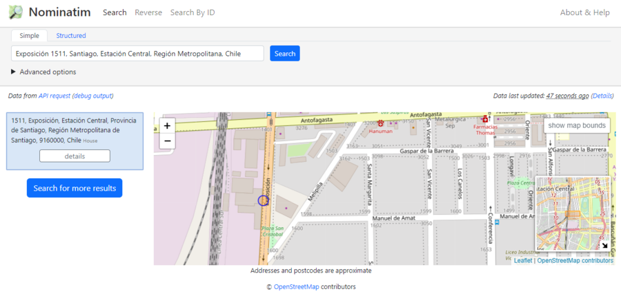
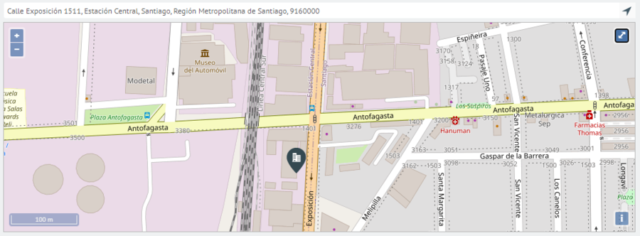
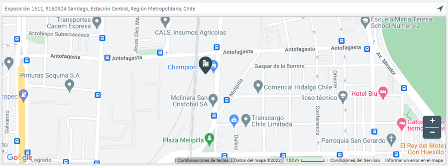
Example 1
- OpenStreet Maps + Nominatim -> Exposición 1511, Santiago, Estación Central, Región Metropolitana, Chile
- OpenStreet Maps + ArcGIS -> Calle Exposición 1511, Estación Central, Santiago, Región Metropolitana de Santiago, 9160000
- Google Maps -> Exposición 1511, Santiago, Estación Central, Región Metropolitana, Chile
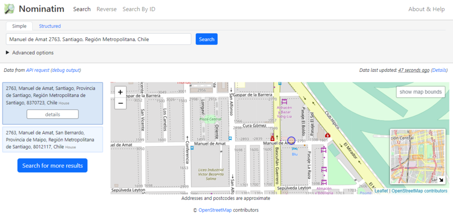
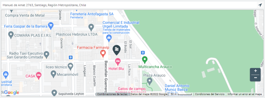
Example 2
- OpenStreet Maps + Nominatim -> Manuel de Amat 2763, Santiago, Región Metropolitana, Chile
- OpenStreet Maps + ArcGIS -> Calle Manuel de Amat 2763, Santiago, Región Metropolitana de Santiago, 8320000
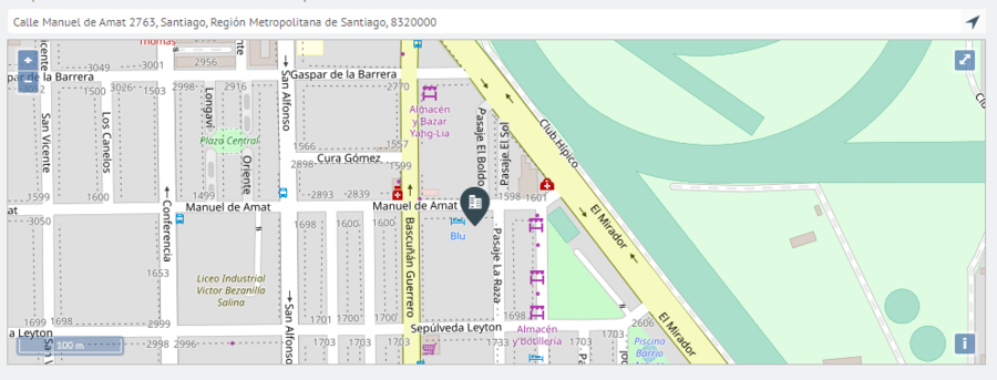
- Google Maps -> Manuel de Amat 2763, Santiago, Región Metropolitana, Chile
MEXICO
Example 1
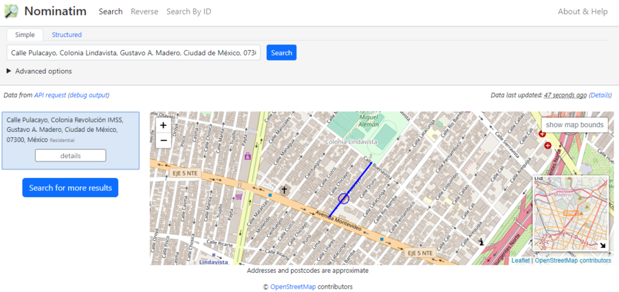
- OpenStreet Maps + Nominatim -> Calle Pulacayo, Colonia Lindavista, Gustavo A. Madero, Mexico City, 07300, Mexico
- OpenStreet Maps + ArcGIS -> Pulacayo, Lindavista, Gustavo A Madero, Mexico City, 07300
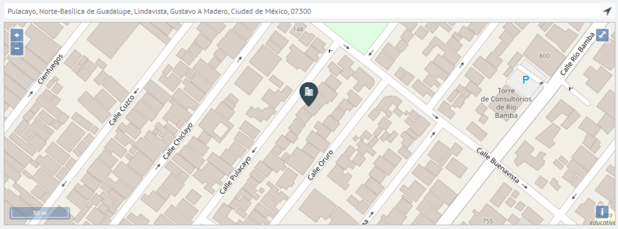
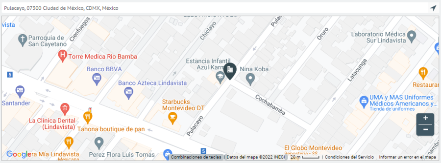
- Google Maps -> Pulacayo, 07300 Mexico City, CDMX, Mexico
Example 2
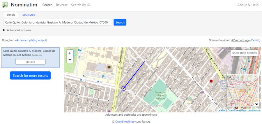
- OpenStreet Maps + Nominatim -> Calle Quito, Colonia Lindavista, Gustavo A. Madero, Mexico City, 07300, Mexico
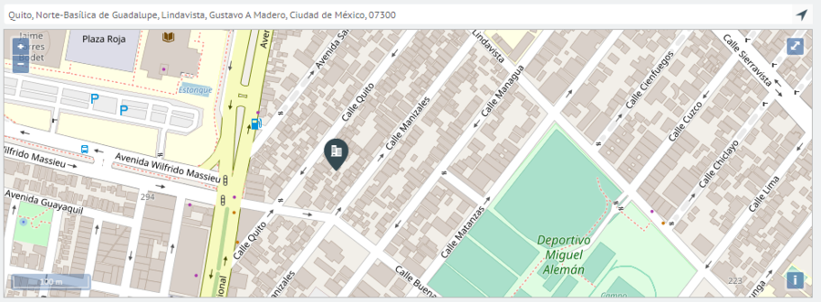
- OpenStreet Maps + ArcGIS -> Quito, Lindavista, Gustavo A Madero, Mexico City, 07300
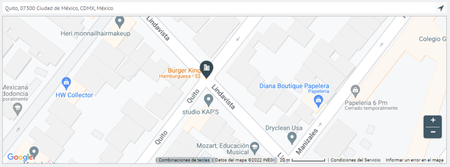
- Google Maps -> Quito, 07300 Mexico City, CDMX, Mexico
BRAZIL
Example 1
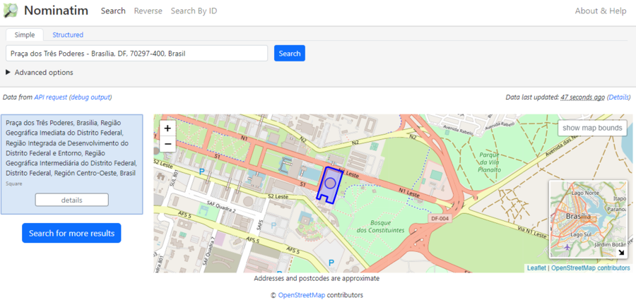
- OpenStreet Maps + Nominatim -> Praça dos Três Poderes - Brasília, DF, 70297-400, Brazil
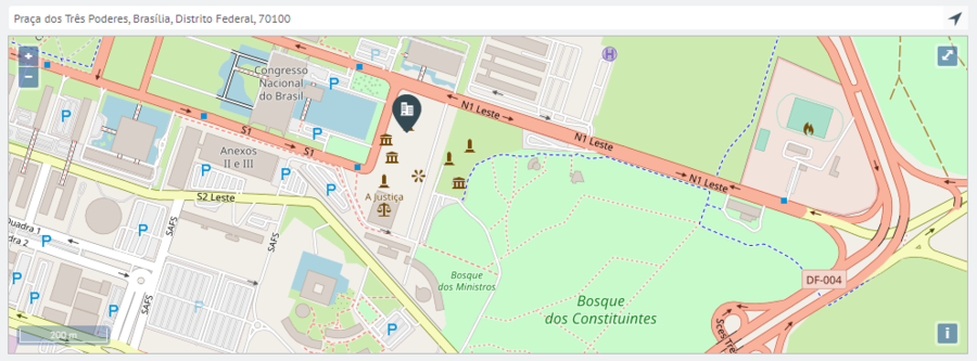
- OpenStreet Maps + ArcGIS -> Praça dos Três Poderes, Brasília, Distrito Federal, 70100
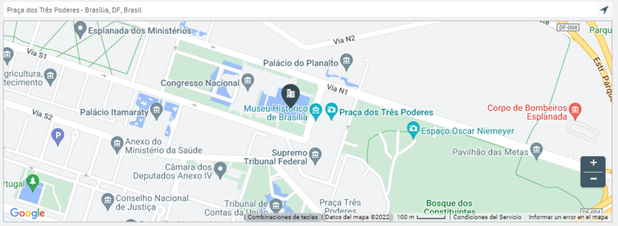
- Google Maps -> Praça dos Três Poderes - Brasília, DF, 70100-000, Brazil
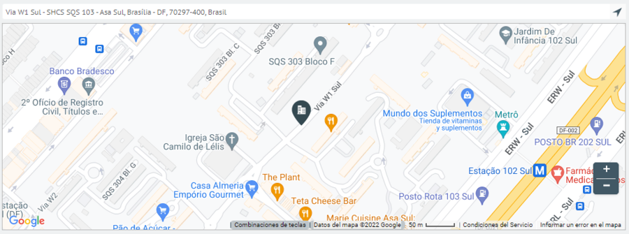
Example 2
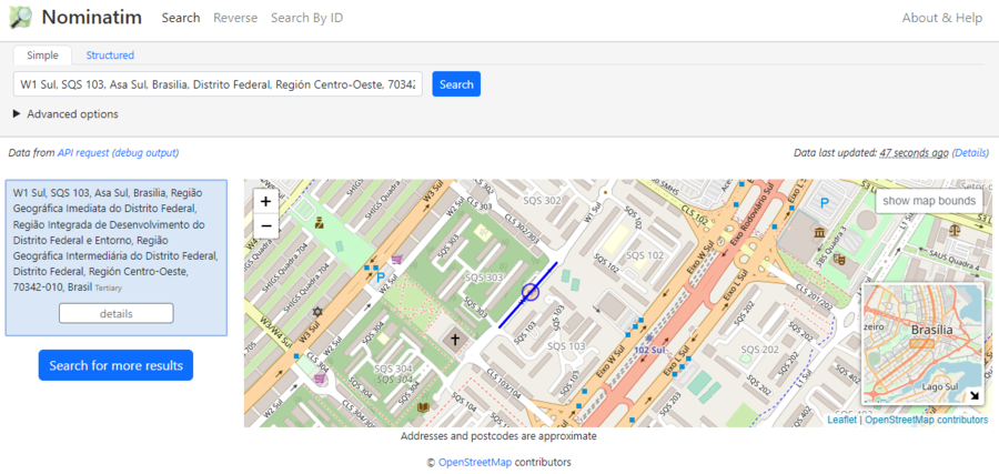
- OpenStreet Maps + Nominatim -> W1 Sul, SQS 103, Asa Sul, Brasilia, Distrito Federal, Región Centro-Oeste, 70342-010, Brazil
- OpenStreet Maps + ArcGIS -> SQS 103, Brasília, Distrito Federal, 70342-000
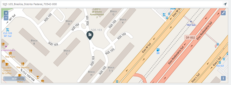
- Google Maps -> Via W1 Sul - Asa Sul Superquadra Sul 103 - Asa Sul, Brasília - DF, 70297-400, Brazil
COLOMBIA
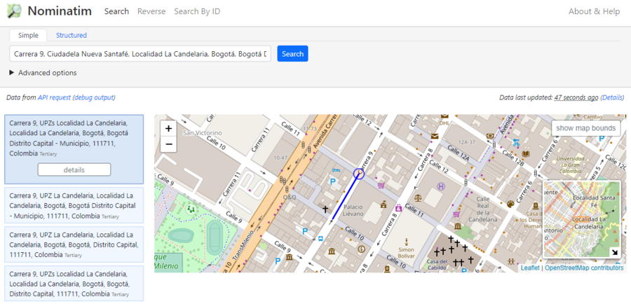
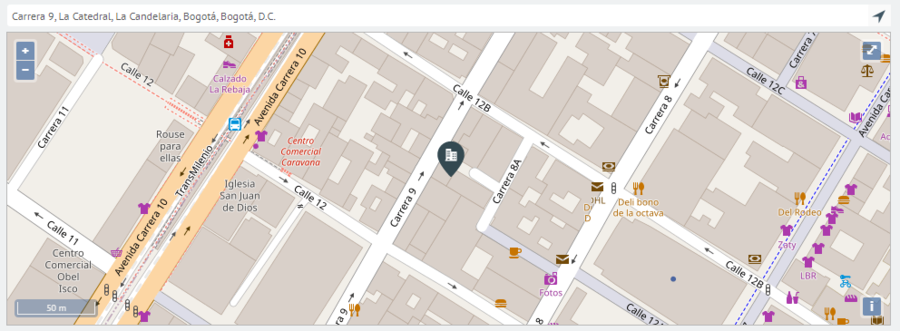
Example 1
- OpenStreet Maps + Nominatim -> Carrera 9, Ciudadela Nueva Santafé, Locality La Candelaria, Bogotá, Bogotá Distrito Capital, 111711, Colombia
- OpenStreet Maps + ArcGIS -> Carrera 9, La Catedral, La Candelaria, Bogotá, Bogotá, D.C.
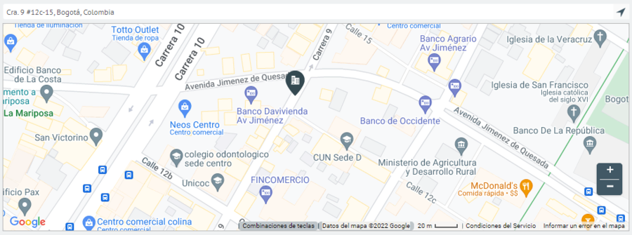
- Google Maps -> Cra. 9 #12c-15, Bogota, Colombia
Example 2
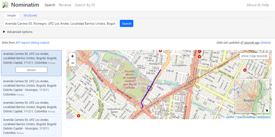
- OpenStreet Maps + Nominatim -> Avenida Carrera 50, Rionegro, UPZ Los Andes, Locality Barrios Unidos, Bogotá, Bogotá Distrito Capital, 111211, Colombia
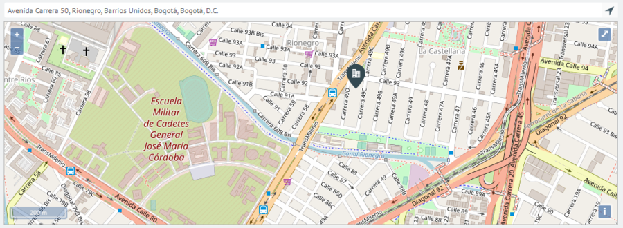
- OpenStreet Maps + ArcGIS -> Avenida Carrera 50, Rionegro, Barrios Unidos, Bogotá, Bogotá, D.C.
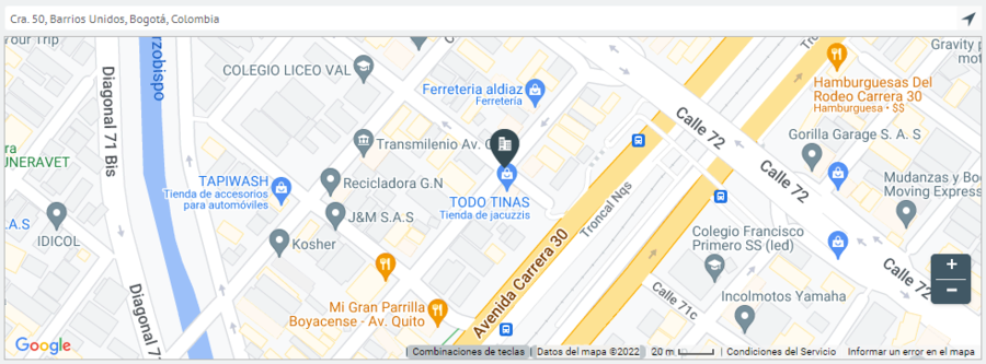
- Google Maps -> Cra. 50, Barrios Unidos, Bogotá, Colombia
Comparative table
| Open Street maps + Nominatim | Open Street maps + Arcgis | Google Maps | |
|---|---|---|---|
| CR 7:15-17 | Carrera 7, Serafina, San Cristóbal, Bogotá, Distrito Capital, 111511, Colombia | Carrera 7 15 17, Veracruz, Santa Fé, Bogota, Bogotá, D.C. | Cra. 7 #15-17, Bogota, Colombia |
| CL 164 15-20 | Calle 164, Gilmar, Suba, Bogotá, Distrito Capital, 111156, Colombia | Calle 164 15 20, El Toberin, Usaquén, Bogota, Bogotá, D.C. | Cl. 164 #15-20, Bogota, Colombia |
| Titan Plaza | Titan Plaza, Calle 86A, Minuto de Dios Engativá, Bogotá, Distrito Capital, 111021, Colombia | Titan Plaza | Av. Boyacá #80-94, Bogotá, Colombia |
| Cra 69 # 98 A - 11 | Carrera 69, Bosque Popular, Engativá, Bogotá, Distrito Capital, 111061, Colombia | Carrera 69 98A 11, Julio Florez, Suba, Bogota, Bogotá, D.C. | Cra. 69 #98a-11, Bogotá, Colombia |