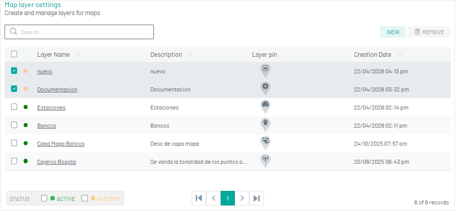
A map layer is a set of georeferenced points that represent places of interest to the business, such as branches, gas stations, warehouses, etc. From this module it is possible to consult, add, edit and delete all map layers as required by the operation.
Create Map Layers
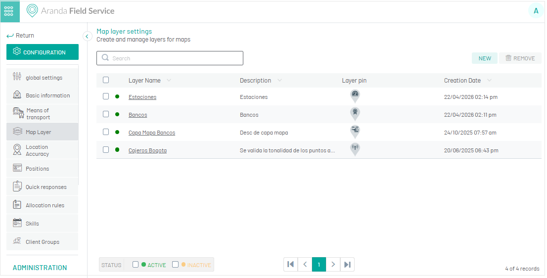
1. To create a map layer, go to the AFLS configuration console, in the Configuration from the main menu, select the Map Layer. In the information view, select the New.
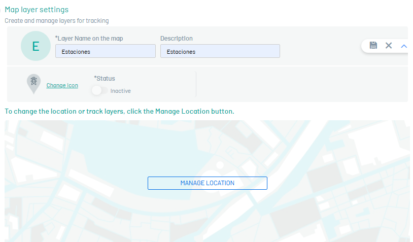
2. In the map layer detail view, you will be able to fill in information such as name and description (required), change icon, and enable the map layer status to be visible from the web or mobile interface
Change the icon
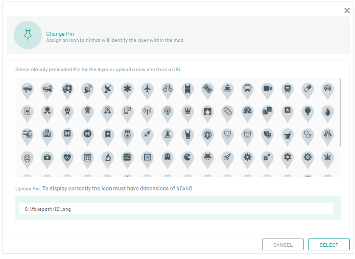
3. Select the option Change icon to customize the icon that represents the points created within the layer.
3. In the window Change Pin Select one of the predefined icons or add a remote URL that leads to the desired image. It is recommended that the icon has dimensions of 40x40 for proper viewing.
4. When you finish the basic map layer settings, click Save  to confirm the changes made.
⚐ Note: To add a location, you must have completed the basic map layer configuration.
Add Location
4. In the Map Layer Detail view, click the MANAGE LOCATION to display the points or locations added to the layer.
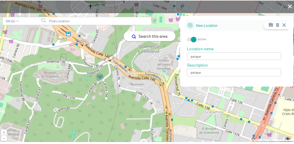
When adding a location to the map layer, you can also add, modify or delete locations manually (one by one) or in bulk, importing files in GeoJSON format, under the international geographic coordinate system World Geodetic System 1984, with units of decimal degrees.
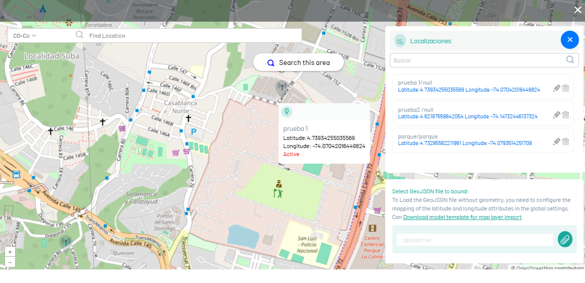
4. From this option, you will be able to edit or delete each point as needed
Edit Map Layers
5. To edit a map layer, in the layer configuration list, select the name of the record you want to edit, the detail view is enabled where you can modify the required information.
Deleting Map Layers
7. To delete a map layer, in the layer configuration list, select the check of one or more records and select the button to delete the associated information.